Badlands Backpacking
I have a new appreciation for the dismay that early pioneers must have felt upon encountering the Badlands of South Dakota. Imposing dirt-and-rock features rising from the prairie, they were a formidable opponent to forward progress. Last weekend, I went backpacking in them.
The Badlands are not for backpacking novices. I was in the Sage Creek Wilderness area of Badlands National Park, which has neither established trails nor sources of water. The summer weather is hot and dry, and the terrain is exhausting.
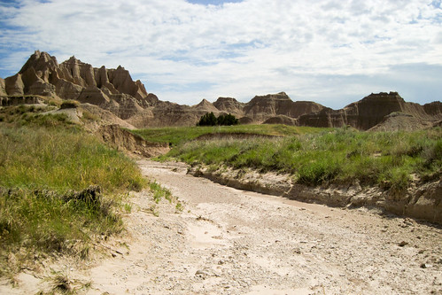
When you’re not hiking up and down bluffs, you’re slogging through soft sand in washes or through knee-high thick grass, which threatens to trip you on every step. You’d better watch those steps, too, because a poorly placed one could find your foot in a prairie dog hole — or worse, on top of an angry rattlesnake.
In exchange, you get fantastic views and immense solitude. I hiked from one of the most popular backcountry access points, and according to the log book, there were only two other hikers out there at the same time I was. Compare that to, say, Yosemite Valley, which is crawling with tourists.
The route I followed is generally known as the Sage Creek Loop. There were no trails, and footprints in the mud are erased whenever it rains, so my guides were my topo map, my GPS, and some vague waypoints. Backpacker.com suggests it as a three-day route, but I did it as an overnight. The 4.1 liters of water that I carried wouldn’t have lasted me through another day.

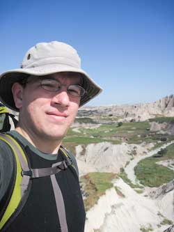
The author in front of Sage Creek Basin
I hiked west from the parking lot, encountered a lush oasis called Deer Haven, did some route finding, did some scrambling, encountered a dead-end on a route up a bluff, and cursed the many curves of the Sage Creek wash. At midday, I was approaching heat exhaustion when I stumbled upon a rare bit of shade in the shadow of a bluff. It was out of the sun, had a nice breeze, was bug free, and wasn’t muddy. Perfect for a couple-hour nap.

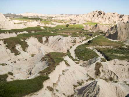
Looking out over Sage Creek
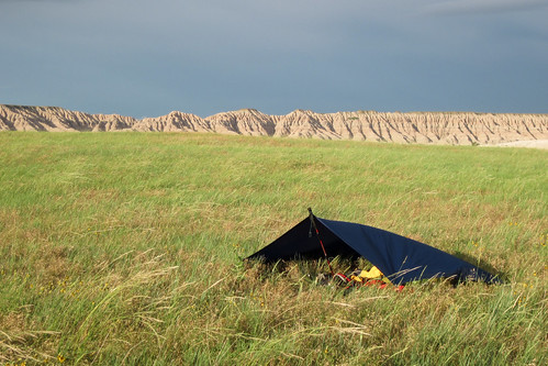
Rejuvenated, I pressed on to the Tyree Basin, where I set up camp on the prairie for the evening. In the background, there were massive banded earthen features. In the distance, thunderheads loomed. I set up my ultralight camping shelter — a tarp and my hiking pole arranged as a lean-to — and hunkered down for the storm.
The rain came, and so did the lightning. I was the only thing on the prairie for some distance, and my hiking pole was made of aluminum, so all I could think of during the storm was, “Don’t die. Don’t die. Don’t die.” I watched the hair on my arm intently for any signs of static buildup, some vague notion in my mind that if I saw impending doom I would somehow be able to run away from the bolt.
When the storm passed, I was treated to a spectacular sunset. A cool breeze blew throughout the night, and I had one of the best nights of backpacking sleep that I can recall.
In the morning, I hiked down the Sage Creek Pass and back to civilization.
Total distance (according to my GPS): 24.0 miles


Badlands is my 2nd favorite national park, next to Glacier…I guess you can tell I’m from the Midwest…
That looks like a fun, albiet dry, hike. Would you recommend it to others?
If you had asked me that while I was nearly overheating on the first day, I would have said “no.” As I was going up and down, up and down, up and down, I found myself thinking that the hike was no fun at all.
However, things improved considerably after my nap. I began to enjoy it more. I saw birds, deer, prairie dogs, a bison, and many beautiful flowers, grasses and cacti. The night sleeping alone on the prairie was exceptional, too.
I would recommend the hike, but I’d also recommend going in the cooler fall months to avoid the agony of the summer heat.
So glad you enjoyed your time in South Dakota! Come back again!
I went out to this loop earlier in the spring only to find myself in over my head. I made it past deer haven and to the top of the ridge, but never found the wash that leads down the other side. Backpacker made it sound like it should be obvious but I had to turn around for fear of getting too lost with a storm coming in. I want to go back this fall and make it through the loop. Do you have any advice on planning my trip back? I can handle the hike and the camping, but am worried I won’t find the trail again. Should I study the topo map for the wash? Get better with GPS? Any help would be appreciated.
Sorry to hear that your trip was cut short!
I was inspired by the Backpacker article to take this hike, but the route I used was only broadly similar to the one they suggested. In hindsight, I believe I entered and left Deer Haven in different spots than they did. There were a few parts near the ridge that turned into the scramble, but I happened to find a smaller peninsula-type ridge on the north side of the main ridge that led me down into the Sage Creek wash. I don’t think that there’s a wash that leads directly from the ridge; it’s more like your goal is to get down the hill and to the wash. Keep in mind that there is no trail, so there is no right or wrong way to do this loop. Just find a spot that looks good, and try it. 🙂
Topo maps are a good thing to have, but many of the features in the Badlands are too small to show up on any except the most detailed.
A few more tips:
– This is definitely an overnight trip, not a 3-day.
– Avoid hiking in the middle of the day. It is very hot and dry.
– Bring lots of water. Four liters was barely enough for me.
– The hiking gets much, much easier once you get out of the wash and start walking through the prairie.
Thanks for the reply! Even though the trip was cut short it was still great. We topped the ridge and hiked around to see the wash from some higher vantage points. It looked like it was so far down that I would have no hope of getting down there without killing myself 🙂
Sounds like I should just take a more general view of it, not trying to find an exact route and just making my goals to go from major point to point. I will look at the maps and see if I can tell what you generally did.
Just as a quick review: you went to Deer Haven, you topped the ridge, found a way down to the wash on the north side of the ridge (by way of a smaller penisula), then hiked around counter clockwise to complete the loop.
Thanks for the tips!
I was wondering if you would have a .gpx file of the route you took through sage creek? I would love to get a hold of one or would you have a link to one?. Thank You
seems to me you could save yourself a lot of hassle and start at the campground at the west end of the wilderness. draw your own map on a paper bag and take your compass. leave the electrons in your car and find true freedom!
@keacher